Measurement, mapping and positioning
Five accessory ports take up to five tools at once: imaging sonars (Oculus, Tritech Gemini, PING360), the Water Linked DVL A50, a Cerulean USBL locator, the 3D UScanner and a laser scaler.
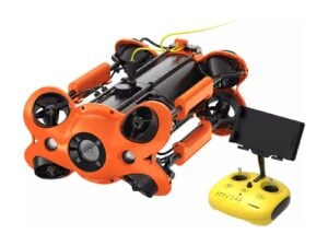
That makes the M2 PRO MAX a compact platform for sonar inspection and positioned survey. Power, buoyancy and mounting must suit the combination; we confirm it in the quote.
How the job runs
- Choose the tools for the output you need.
- Mount and balance the payload.
- Set up USBL reference if used.
- Fly lines; hold station with the DVL.
- Process sonar and positions.
What you get
- Sonar images
- Positioned video
- 3D scans with the UScanner
Plan for
- Depth
- Up to 200 m
- Payload
- Balance tools for steady flight
- Integration
- Confirmed per tool
Best packageAdvanced Set →
Add-ons that help
Watch out Each extra tool changes power draw, buoyancy and handling.